
THE MOUNT ARROWSMITH BIOSPHERE REGION
The MABR is situated within the traditional territories of seven First Nations communities and shares similar boundaries with the Regional District of Nanaimo. The biosphere region is approximately 1200 square kilometers. The vertical elevation spans just over 2100 meters from the highest peak on Mt. Arrowsmith (1817m) to 300 meters into the Salish Sea. This vertical range makes the MABR unique among Canadian Biospheres.
The geographical boundary is defined by five watersheds: Englishman River, Little Qualicum, French Creek, Nanoose Creek, and Bonnell Creek.
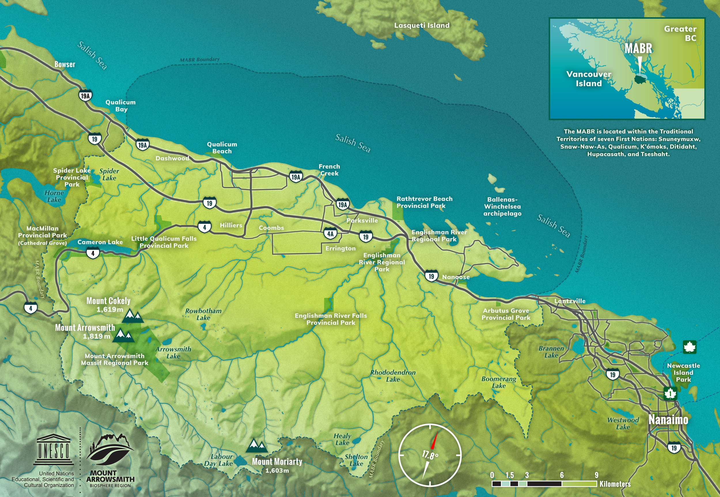
There are over 48,000 people living within the boundary of the MABR, most of whom live within five kilometers of the Salish Sea. The average age of citizens within the MABR is 60 years, which is the highest average age per capita in Canada.
MABR Interactive Map
Follow the link below to view an interactive map of the MABR created and updated by the Mount Arrowsmith Biosphere Region Research Institute (MABRRI). Data layers displayed on the map come from a variety of sources, including the results of MABRRI projects in the region.
This map is meant to be used as a knowledge-sharing tool and to showcase the work of MABRRI student researchers. The map is not to be used for navigational purposes and MABRRI is not responsible for the accuracy of the information provided by external sources.